Saturday, 30 August 2008

30 August 2008

Todays walk saw us once again at the Ladybower Reservoir area, but this time we were heading up to Alport Castles... We set off from the car park at 09:35 and returned to the car at 17:35... A darn good day out!!!

Why is it that nine times out of ten we end up going uphill at the very start of the hike?


A close up of us both will reveal that we were leaking... a lot... The weather, whilst overcast was touching the bottom 70's...


One I took on the camera phone...


And then Dave took one with my "big camera"...


While Dave had the camera he decided to take another photo, this time of some Foxgloves...
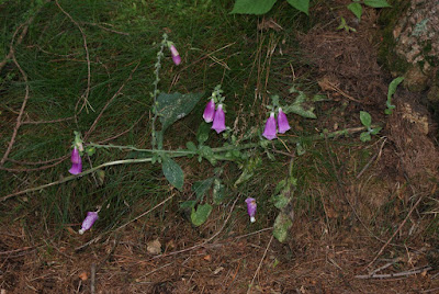

I then showed him how to take a better picture of them by getting down to their level... We'll make a photographer out of him yet!!!


Anyhow, the views once we got up and out of the woodland were a bit disappointing, mainly due to the overcast/misty weather... The view down into the Woodlands Valley (the main A57 Sheffield - Manchester road runs through the bottom)...


Dave and I both have "stile"... Oh hum, we thought the caption was funny...


No, I have no idea why he's puffing his chest out either...


"Top of the world Ma!"...


The view down to Ladybower Reservoir from Rowlee Pastures...


Approaching Alport Castles...


Closer to Alport Castles...


"The Tower" to the right of centre...


We decided to stop for a bite to eat here... To the right of where we sat...


To the left of where we sat...


The view down...


Even Jack was admiring the view...


Sat down, lunch time...


Jack sat between us, admiring the view again...


And after a spot of lunch we headed off down Birchinlee Pastures back towards the Derwent Reservoir...


Back on the same level as the reservoir, a stream we came across....


Then it was off over the river Ashop near to the Slippery Stones... I let Dave go first... Well, I have got the camera to look after...


Halfway over...


What is not shown is where we sat, initially, for something else to eat... About 20 metres from the stepping stones above... Got everything out, sat down and BAM!! mosquitoes surrunded us... both Dave and myself are covered in mozzy bites on our arms and legs... Itchtabulous!

Derwent Reservoir...The Slippery Stones are at the far end on the other side of the woodland...


Dave's photo of the Derwent Dam...


My photo of the Derwent Dam...

Sunday, 24 August 2008

August Bank Holiday Weekend 2008

This weekend saw us over at Saltfleet on the East Coast of the UK again...

Samphire reflected...


Marsh grass in puddle...


Trawler...


Seal...


Samphire "Forest"...


Close Up Samphire...


Common Reed...


Wheat...


Common Reed...


Mute Swan...


Mute Swan with Cygnet...


Four-Spotted Chaser Dragonfly...


Tree with upturned leaves...


Unidentified (as yet) fungus... Any Mycologists out there feel free to identify :)

Sunday, 10 August 2008

10 August 2008

Today saw us on the heather moor around Surprise View...

Most of it is bloom now...


The view into the Hope Valley, with Mam Tor to the left...


Another view into the Hope Valley with Win Hll to the right of centre...


It's a rocky place at this end...


Those are the rocks we were on when we last visited here in March 2006...


Sometimes it's a bit of a drop...


Looking beyond the Hope Valley to the Kinder Plateau at the back...


We decided we'd make our way over to this rock formation and climb to the top...


We wondered what would get there first... Us or the Rain?


I noticed a millstone in amongst the fallen rocks...


And then it was time to ascend... No, we're not ascending like mountaineers.. there's a sort of path!!


And here's Rebecca on her way up...


Almost there!


W00t! on the top, AND there before the rain!


Tine for a spot of something to eat, despite the wind!


Thought I'd try an arms length self pic with the "big" camera, it was too close!


A lot easier with the camera on my phone!


Oh bugger! More rain on it's way... this rain got us... Fortunately it was only a small shower and quickly blew over...


The path to Carl Wark (an Iron Age fortress that was further fortified by the Romans)... No we didn't have to climb through the rocks!


An ancient wall at Carl Wark...


A trough of some sort...Certainly man-made...


Is this wall original or a Roman fortification?


Me at Carl Wark, with the Hope Valley behind...


Being watched... always!


The walk above was only a short one, so we decided to head into Castleton and attempt to get Rebeccaa up Mam Tor, she'd never been up there, she was always scared of being that high... Our target, Mam Tor taken from near Odin Mine...


We went a different way up, heading towards Hollins Cross but joining the main pathway before we got there... I didn't get the time to take any pics on the ascent... So, here we are.. Rebecca at the Trig Point, 517m high in the wind... Congrats Rebecca for conquering your fear...


And then we descended, this is the landslip from the old broken road...


No, I have no idea what I'm doing either!!


Rebecca, looking a lot better just before we went onto the old road...


The old A6187 road... Closed in 1979 due to landslip after a particularly dry summer and a wet winter (1976)...


Rebecca's next target... that solitary tree... In can be seen for miles...


Foxglove growing out of the bracken... There's a bee inside on of the flowers, I was hoping to catch it on it's way out...


The entrance to Odin Mine...